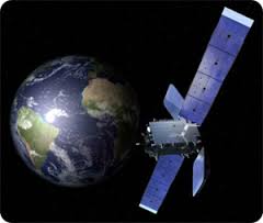
Satellite navigation signals, such as the ones transmitted using a GPS constellation, contain valuable information on the medium in which they are propagated (the atmosphere), as well as on the surfaces that reflect them (oceans, polar ice caps, some landscapes…). It was over 20 years ago that scientists first developed new ways of using these signals to extract information from the Earth’s system (meteorology, oceanography, climate). The Earth observation team at the Institute of Space Science has been a pioneering body in some of these techniques, including GPS reflectometry and radio-occultation. In March 2016, the first Spanish Earth observation satellite (named PAZ) will be launched. The ICE’s Earth observation team will be using this satellite to test a new approach for measuring intense rainfall, based on GPS signals (ROHP-PAZ experiment). In this lecture, the speaker will explain – in easy-to-understand terminology – how GPS systems work, how they can be used for monitoring the Earth, as well as various details and anecdotes from the new space mission.
To see real-time conference click here: